
Understanding the geography and history of the Gulf of Kavala is an intuitive way to start, moreso because it sheds some light on the context of the Warriors project. And, of course, because it’s best to place the sites that we will be discussing on the map as soon as possible.
Geography
To begin with, observe the map below:
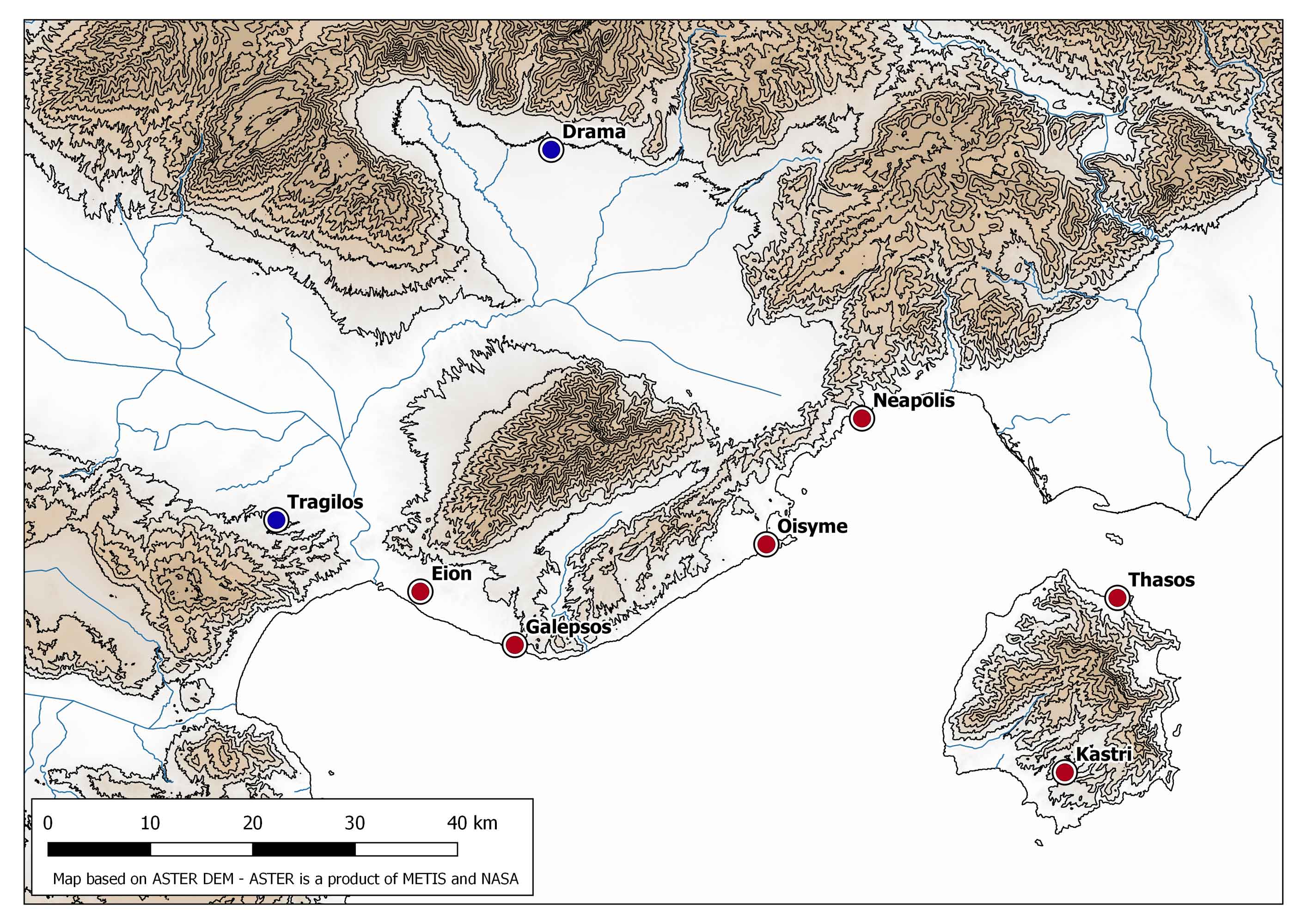
–The Gulf of Kavala and neighbouring regions
Sites marked in red are ‘core’ sites for the project (i.e. sites that lie in Thasos itself or its immediate peraea). Sites marked in blue are sites that I am interested in exploring as points of comparison. They lie beyond the Gulf of Kavala, but they are contemporary to some of our ‘core’ sites, and I believe I can better answer my research questions if I investigate the differences and similarities between the Thasian region and its immediate surroundings.
The island of Thasos can be seen on the bottom right of the map. Note the two ‘core’ sites of the island: the Early Iron Age settlement of Kastri and the polis of Thasos itself. These two sites did not coexist (or, if they did, it was for a very short period during the early 7th century BCE): Kastri is a much earlier settlement.
Note the placement of these sites. Kastri lies on the top of a steep hill, in the mountainous hinterland of southern Thasos. It is difficult to approach, but it dominates the surrounding region.
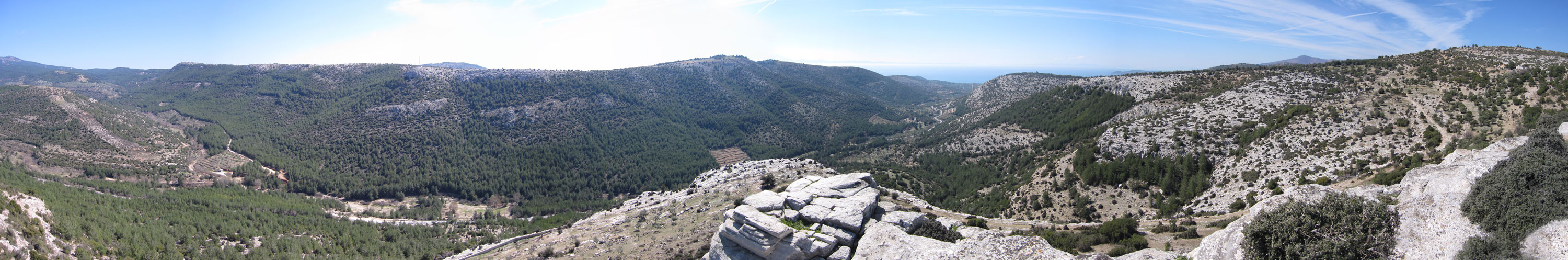
–Panoramic photograph, taken from the top of Kastri.
On the other hand, the polis of Thasos was founded on the northern coast of the island, making use of a very good natural harbor.
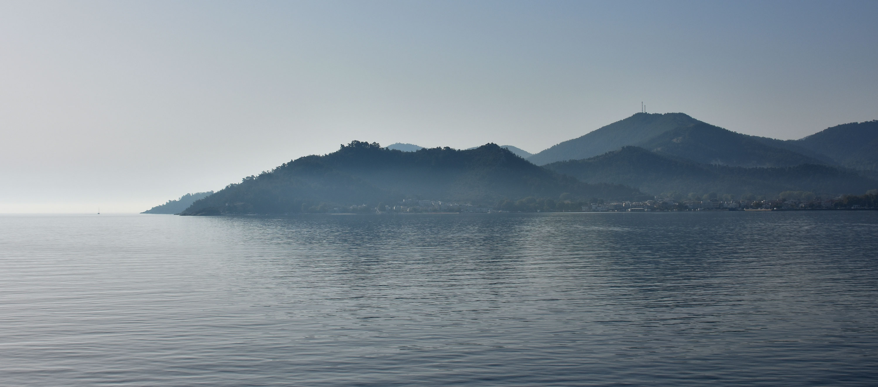
–The acropolis of Thasos, from the northern seaborne approach.
In the opposite coastline (or peraea, if one adopts the Greek term) we can find two major sites: Neapolis (modern Kavala) and Oisyme. Both settlements were founded during the mid-7th century and both evolved into poleis themselves. Here too, we find coastal settlements, which is not surprising. Note the mountain ridge that skirts the coastline immediately to their north, and makes accessing the hinterland relatively difficult – the easiest path is located just to the north of Neapolis.

–Panoramic photograph, taken from the Oisyme acropolis.
If we follow the coastline to the west, we find ourselves at the foothills of Mt. Symbolon. At the westernmost end of this mountain, on a coastal hill, we find the relatively unexplored site of Galepsos, tucked between the mountain and the sea.
Note that the site lies very near the western end of the long and narrow valley, which separates Mt. Symbolon from Mt. Pangaeon, to the north. Mt. Pangaeon was well-known in antiquity for its gold and silver mines and it is thought by many to have been the cornerstone of Thasian wealth.
The site of Eion lies a short distance to the north-west; like Galepsos, it may also have served to control the paths from the coastal region to the hinterland. An honorary inscription dating to the end of the 6th century BCE informs us that the Parian colonists had fought alongside local Thracian tribes in defense of ‘much-desired/beloved Eion’ (SEG 27:249). Strategically placed near the rich Pangaion foothills, only a short distance from the sea and near the very important delta of the river Strymon, it is not difficult to see why Eion would have been a contested site.
Note that the available paths from the coast to the hinterland are relatively limited, and that new settlements (Neapolis, Galepsos, Eion) were founded to secure them. Could this difficulty in traversing the landscape result in differences in martial technology and ideology between the coastal regions and the hinterland? Or can we trace population interactions and / or martial conflict along these routes?
This is where the sites of Drama and Tragilos come into play (and why I wish to include them in my study). Drama lies near the northern limits of the large Aggites river plain, and presents us with an Early Iron Age tumulus cemetery. Tragilos, on the other hand, lies relatively near to Eion, but on the northern side of the Amphipolis pass, on a hill bordering the Strymon river plain. It is a Greek colony, founded somewhat later than the coastal sites, but still well within the Archaic period. They were both excavated in the ‘70s, and they have both yielded weapons in funerary contexts. Therefore, they can provide us with a pre-colonial (Drama) and post-colonial (Tragilos) comparison point from outside the Thasian peraea.
Next up: History!